Flood risk and buying a house: reading the maps without overreacting
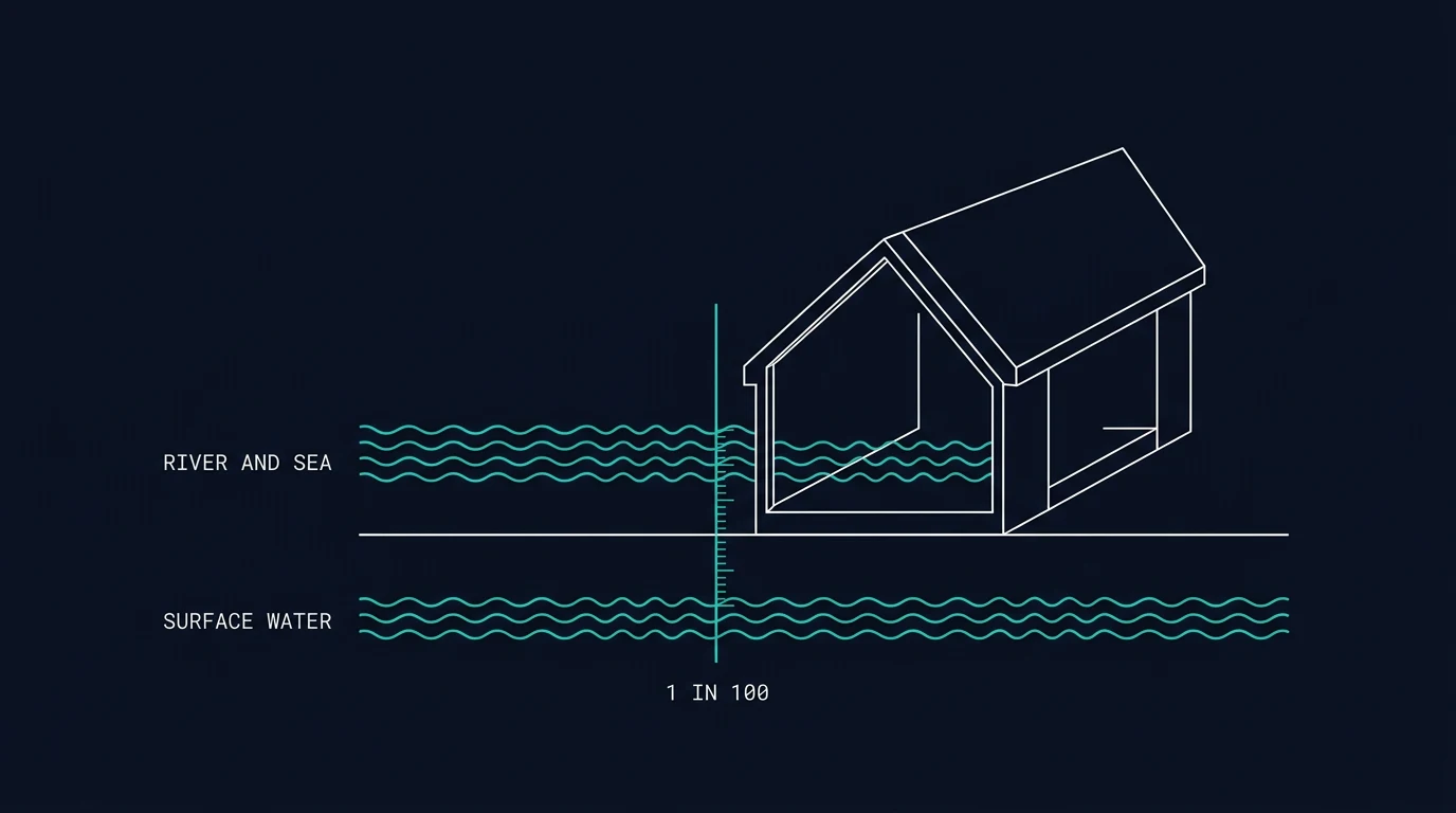
Flood risk in England is published as open data, mapped street by street, and easy to misread. Two people can look at the same shaded patch on the same map and reach opposite conclusions — one sees a reason to walk away, the other sees a drainage ditch and a slope. This guide sets out what the official maps show, what they deliberately do not show, and the questions that get you closer to an answer about one building.
The four sources of flooding that are mapped
The Environment Agency's long term flood risk service covers England and reports on rivers and the sea, surface water, reservoirs and groundwater where data exists. Wales, Scotland and Northern Ireland publish their own: Natural Resources Wales, SEPA's flood maps and NI Direct.
They are not equally useful.
Rivers and sea. This is the oldest and most developed dataset. It takes account of the presence and condition of flood defences, which is why an area behind a defence can still show a risk class rather than a blank.
Surface water. Rain that overwhelms drains and lies on or runs over the ground. The Environment Agency rebuilt this map in 2025 using a new national model, refined with local authority modelling where it exists, and it now accounts for climate change projections for mid-century. It states that over 4.6 million properties in England sit in areas at risk of surface water flooding. Surface water can appear far from any river, in places residents do not associate with flooding.
Reservoirs. Covers large raised reservoirs of 25,000 cubic metres or more. The risk is low but the consequence is severe, and the map reflects that combination.
Groundwater. Where data exists, and the thinnest of the four.
What the likelihood bands mean
The bands describe the chance of a flood in any given year, not a return period in the colloquial sense:
- High: 3.3% or more (1 in 30) in any year
- Medium: between 1% (1 in 100) and 3.3%
- Low: between 0.1% (1 in 1,000) and 1%
- Very low: less than 0.1%
A 1% annual chance is not "once a century". It is 1% every year, which compounds: roughly a one in four chance of at least one event over 25 years. That reframing is the difference between dismissing a "low" result and understanding it.
What the maps do not tell you
The service says plainly that it does not show how likely an individual property is to flood, and it does not cover flooding from blocked drains or burst pipes.
The surface water model has further limits worth knowing. It is national-scale modelling, with buildings raised by 30 centimetres in the terrain data, footprints infilled where they would otherwise appear dry, and water shallower than 75 millimetres removed. Those are sensible processing choices, but they mean the map answers "is this area in a zone where surface water collects?" rather than "will this house take on water?"
Local knowledge fills the gap. Neighbours, the local flood authority and the parish council often know which corner of a street floods and which does not.
The questions that move the needle
Ask the seller, in writing. The property information form in England and Wales includes direct questions on flooding, insurance and any previous flood damage or claim. A refusal to answer is itself information.
Read the environmental search. Your solicitor's search reports on flood risk and may flag the property as being in an area at risk. It is a starting point, not a conclusion.
Check recorded flooding. The Environment Agency publishes recorded flood outlines, and gov.uk explains how to request the flooding history for an area.
Check the insurance quote, not just the price. The flood element of a buildings policy, and whether an excess is raised for flood, is a more direct read on how the market sees the address than any map class.
Sign up for warnings. The flood warning service covers rivers, sea and some groundwater. It does not currently cover surface water, because intense local rainfall is too hard to forecast at that resolution.
Flood Re, briefly
Flood Re is a reinsurance scheme, funded by a levy on insurers, that lets insurers pass the flood part of a household policy to a pool at a fixed price. It is not a subsidy you apply for, and it does not appear on your policy.
Eligibility is specific: domestic properties in council tax bands A to H, used for private residential purposes, insured individually, and built before 1 January 2009. Homes built after that date are excluded, on the reasoning that planning should have kept new development out of the highest-risk areas. Flood Re applies across the UK but not the Isle of Man or Channel Islands, and the excess on a ceded claim is £250.
Some insurers also offer Build Back Better as part of a flood claim, reimbursing resilient repairs up to a set limit, £10,000 in the scheme's terms. Whether a given policy includes it is a question for the insurer.
What actually changes the outcome
The distinction practitioners draw is between resistance and resilience.
Resistance keeps water out: flood doors and temporary barriers, self-closing air brick covers, non-return valves on waste pipes, sealed cable entries, and a pump or sump where water can arrive from below.
Resilience limits the damage when water gets in: solid or tiled floors instead of carpet, plasterboard replaced with a water-tolerant board up to a metre, sockets and boilers raised, and kitchen units on legs rather than plinths.
Neither changes the mapped class. Both change the bill and the months of disruption. For a buyer weighing up a property in a medium band, the useful question is not only "will it flood?" but "what would a flood cost here, and what would reduce that cost?"
Government guidance on adapting a home to flood risk sets out the measures in more detail, and the National Flood Forum and the property flood resilience guidance from the Environment Agency are the practical references.
Putting it together
A sensible sequence for one address:
- Check the long term flood risk service for all four sources, and read the climate change layer rather than only the present-day one.
- Cross-check surface water at a finer scale, since the national model smooths out local detail.
- Ask the seller and the solicitor for flood history, claims and any resilience work already done.
- Get an insurance quote before exchange, and note the flood excess rather than only the premium.
- If the property is in a band you are not comfortable with, price in the measures you would install and decide with that number in front of you.
Questions
Does a '1 in 100' flood risk mean it floods once a century?
No. The Environment Agency bands are annual chances: 1 in 100 means a 1% chance in any given year. Over a 25-year mortgage, a 1% annual chance adds up to roughly a one in five chance of at least one such flood event affecting the area, which is why the wording matters more than it looks.
Is my postcode's flood map result about my house?
It is about the area around the postcode, not the building. The Environment Agency states that its long term flood risk service cannot say how likely an individual property is to flood, and the surface water map is built from national modelling at a coarse resolution. A house on a rise inside a shaded patch can behave very differently from one at the bottom of the same street.
Will flood risk stop me getting a mortgage or insurance?
Insurers and lenders make their own decisions, and the Environment Agency has no role in them. Flood Re exists to keep the flood element of household cover more available for homes at higher risk: it applies to domestic properties in council tax bands A to H that were built before 1 January 2009, among other criteria. It does not apply to homes built after that date.
Can I find out whether a property has flooded before?
Yes, in part. The Environment Agency publishes recorded flood outlines for England, and you can request the flooding history for an area through gov.uk. Your solicitor's environmental search and the seller's property information form should also raise direct questions about flooding at the address.
What actually reduces flood damage in a house?
Two different things. Resistance measures keep water out, such as flood doors, temporary barriers and self-closing air bricks. Resilience measures limit the damage when water does get in, such as tiled or solid floors, raised sockets and non-return valves on waste pipes. Neither changes the mapped risk; they change the cost and disruption of a flood.
Sources
- Environment Agency — check the long term flood risk for an area in England
- Environment Agency — risk of flooding from surface water: understanding and using the map
- Environment Agency — risk of flooding from rivers and sea dataset
- GOV.UK — get flood warnings by text, phone or email
- GOV.UK — request a flooding history for an area
- GOV.UK — adapting your home or business to the risk of flooding
- Flood Re — how Flood Re works
- Flood Re — eligibility criteria
- Natural Resources Wales — check your flood risk by postcode
- SEPA — flood maps